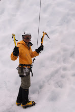
Over the last couple of weeks, I've been studying track notes and poring over maps to come up with a plan to get on most of Victoria's Highest Mountains in one trip next winter.
Start: Diamantina Hut, Great Alpine Road, near Mount Hotham
End: Mountain Creek Campground, near Tawonga
Mountains to be Summited:
(in walking order)
Mt Feathertop (1922m)
Mt Jim (1818m)
Mt Cope (1837m)
Mt Nelse West (1893m)
Mt Nelse North (1885m)
Mt Bogong West Peak (1965m)
Mt Bogong (1986m)
THE PLAN :

Day One: Cross the exposed Razorback Trail (11km) and camp near Federation Hut. Ascend to the summit of Mt Feathertop (1922m). If it's windy or snowing heavily, get up to Federation Hut via Bungalow Spur from Harrietville instead.
Day Two: Attempt Mt Feathertop again in the morning if the weather is clear. There should be plenty of time to get up Molly Hill and Little Feathertop as well if the weather is clear. Head down the steep Diamantina Spur down to the river, make camp near Blair's Hut.
Day Three: Get up on the Bogong High Plains and climb Mt Jim and Mt Cope. Probably will camp at Cope Hut. I wonder if I'll see any brumbies on this day.
Day Four: Cross the wind swept plains past Langford Gap to reach Fitzgerald Hut. Potentially organise a food drop from Falls Creek.
Day Five
It might be very windy and icy on Day 5 walking on the exposed Quartz Ridge to the highest point of Victoria. Unfortunately there is no other way to get there. Hopefully the wind won't rip us off the mountain on the way to Mt Bogong West Peak after passing Mt Nelse and Timm's Lookout. Get on the summit of Mount Bogong, and either camp at Gorge Gap or camp at Cleve Cole Hut.
Day Six
One more crack at Mt Bogong then time to head back. Get out of the cold and descend to Mountain Creek Camping Ground via the Staircase Spur.
Start: Diamantina Hut, Great Alpine Road, near Mount Hotham
End: Mountain Creek Campground, near Tawonga
Mountains to be Summited:
(in walking order)
Mt Feathertop (1922m)
Mt Jim (1818m)
Mt Cope (1837m)
Mt Nelse West (1893m)
Mt Nelse North (1885m)
Mt Bogong West Peak (1965m)
Mt Bogong (1986m)
THE PLAN :

Day One: Cross the exposed Razorback Trail (11km) and camp near Federation Hut. Ascend to the summit of Mt Feathertop (1922m). If it's windy or snowing heavily, get up to Federation Hut via Bungalow Spur from Harrietville instead.
Day Two: Attempt Mt Feathertop again in the morning if the weather is clear. There should be plenty of time to get up Molly Hill and Little Feathertop as well if the weather is clear. Head down the steep Diamantina Spur down to the river, make camp near Blair's Hut.
Day Three: Get up on the Bogong High Plains and climb Mt Jim and Mt Cope. Probably will camp at Cope Hut. I wonder if I'll see any brumbies on this day.
Day Four: Cross the wind swept plains past Langford Gap to reach Fitzgerald Hut. Potentially organise a food drop from Falls Creek.
Day Five

It might be very windy and icy on Day 5 walking on the exposed Quartz Ridge to the highest point of Victoria. Unfortunately there is no other way to get there. Hopefully the wind won't rip us off the mountain on the way to Mt Bogong West Peak after passing Mt Nelse and Timm's Lookout. Get on the summit of Mount Bogong, and either camp at Gorge Gap or camp at Cleve Cole Hut.
Day Six
One more crack at Mt Bogong then time to head back. Get out of the cold and descend to Mountain Creek Camping Ground via the Staircase Spur.
Note:
Let me know if you are interested!!! I will be doing lots and lots of training prior to the trip.
- We probably will allow two days for bad weather
- We will carry an EPIRB beacon, snow shovel, crampons, ice axes, 4 season alpine tents, shellite stoves, etc.
Let me know if you are interested!!! I will be doing lots and lots of training prior to the trip.


